Austin weather: Beryl moves inland impacting parts of Central Texas
Austin weather: Beryl's impacts on Central TX
Beryl made landfall as a Category 1 hurricane. Zack Shields and Leslie London track the storm and talk about its impact on our area.
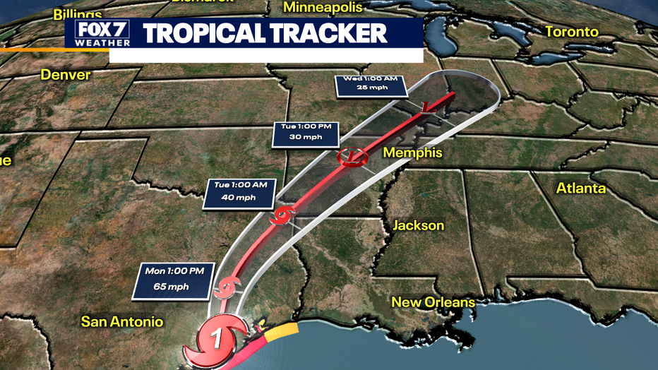
AUSTIN, Texas - Beryl did end up making landfall in Matagorda as a Category 1 hurricane.
As the storm moves farther inland, it is expected to decrease in strength and downgrade back into a tropical storm. The center of the storm is just west of Houston this morning.

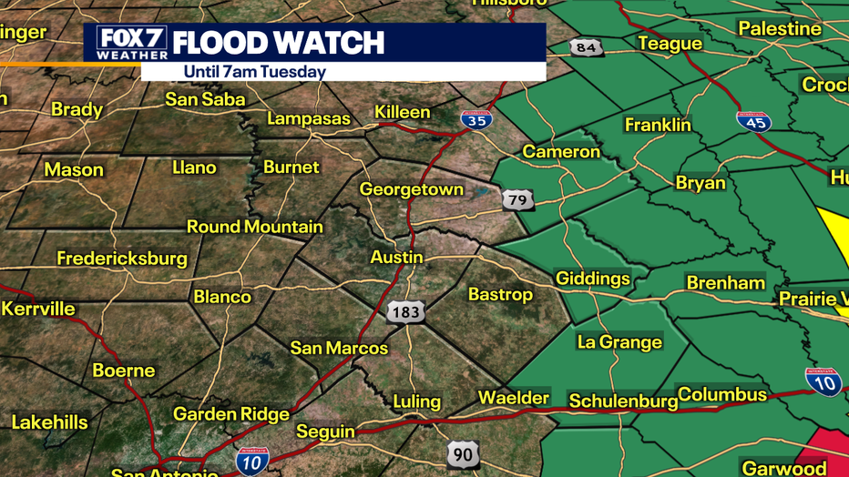
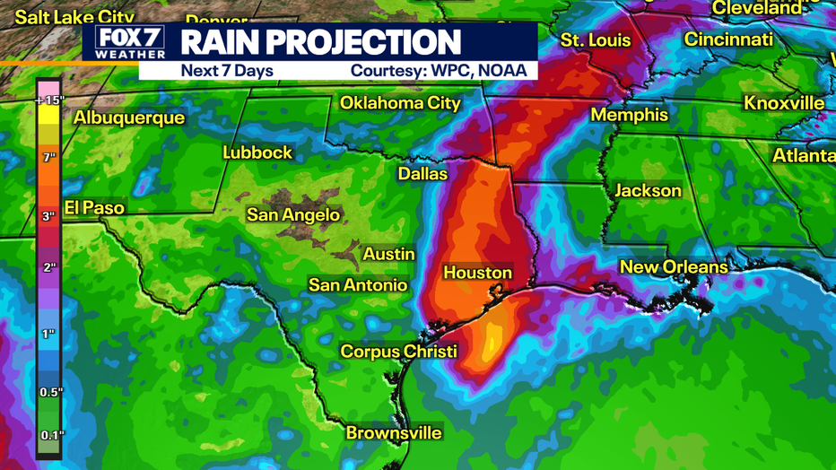
The system is compact, so our eastern areas are just getting clipped by the storm. Milam, Lee, and Fayette County are all under Flood Watches until tomorrow (7/9) morning.
Fayette County is under a Tropical Storm Warning, mainly due to the fact that this area could receive tropical storm force winds (39-73 mph), but heavy rainfall is still a potential risk and isolated tornadoes.

Beryl will be moving northeast through the day and looks to be away from our area by the late afternoon. Those farther west will have minimal impacts if any.
We could see some isolated shower chances and strong wind gusts.

The storm has brought us more moisture, but will keep our temperatures slightly lower today, with the highs around 90 degrees.
By tonight we should be quieting back down, with lows in the low 70s and even areas dropping to the upper 60s.

Track your local forecast for the Austin area quickly with the free FOX 7 WAPP. The design gives you radar, hourly, and 7-day weather information just by scrolling. Our weather alerts will warn you early and help you stay safe during storms.

