

Austin weather: Cold front to bring heavy rain, flood risks, and cooler weather
Austin weather: September 27 morning forecast
A cold front is finally coming! We will get some much-needed rainfall and of course, some cooler weather
AUSTIN - Summer heat is making a final push across Central Texas before a strong cold front arrives later this week, bringing much-needed rainfall, a drop in humidity, and temperatures well below average for the first time in months.
Sunday forecast
Big picture view:
Current morning temperatures range from the 60s to low 70s—including 71 degrees in Bastrop and 73 in Austin and Burnet—under mostly cloudy skies. While a few light, green-level showers were spotted Sunday morning in San Saba County and parts of the Hill Country, most of the region will remain dry with mostly sunny skies.
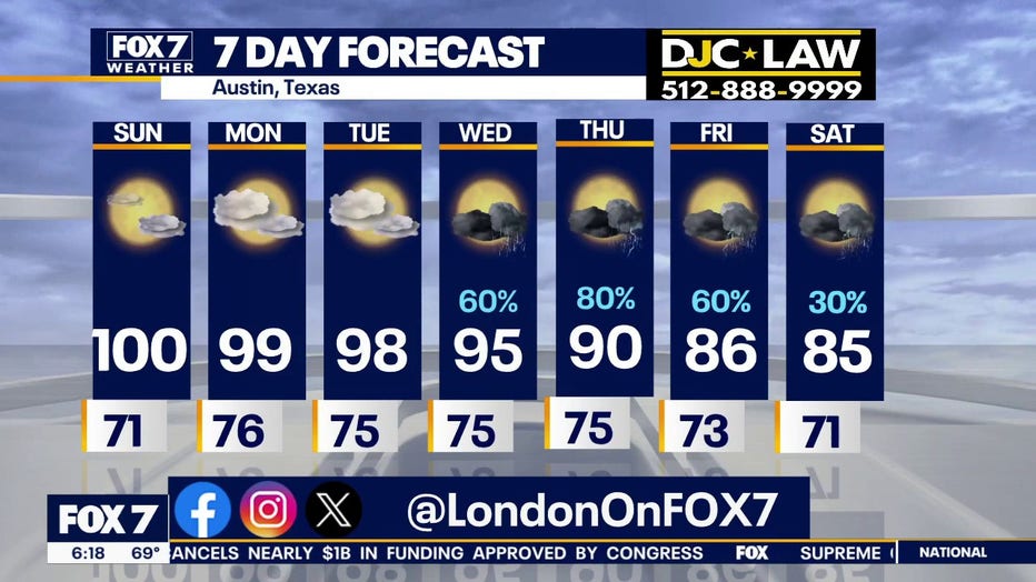
Highs on Sunday are expected to soar into the mid-to-upper 90s, with some areas touching or hitting the 100-degree mark.
Summer really continues right now. Hang in there, though, because you've only got a couple more days and then temperatures are going to start to go down.
When will it rain?
The weather pattern begins to shift late Tuesday into Wednesday as showers and storms move ahead of an approaching cold front. Rain chances will ramp up significantly through Wednesday, Thursday, and Friday, carrying into next weekend.
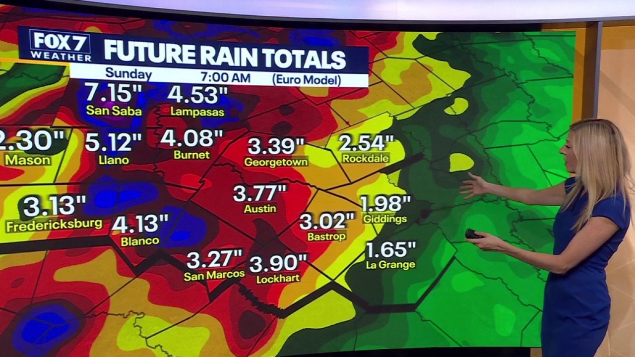
Because regional soils are very dry, we are monitoring a potential flooding risk for Wednesday and Thursday as heavy tropical moisture moves in. Current models project widespread rainfall totals between 1 and 3 inches, with some isolated areas seeing even higher amounts.
Once the front clears, Central Texans can expect a dramatic cool-down and a welcome drop in humidity. High temperatures by the end of the week and into next weekend are expected to drop into the mid-80s—falling below the seasonal average of 89 degrees for the first time this month.
7-Day forecast
The Source: Information in this article is from the FOX 7 Austin weather team.