Austin weather: Slight risk for severe storms in Central Texas
AUSTIN, Texas - Rainy, stormy and cooler times are ahead and all the ingredients are coming together for the best chances of rain we have seen in the last two months.
A cold front along with a potent upper low will collide with the warmth and moisture to turn on the spotty light rain during the day and heavy rain and storms tonight.
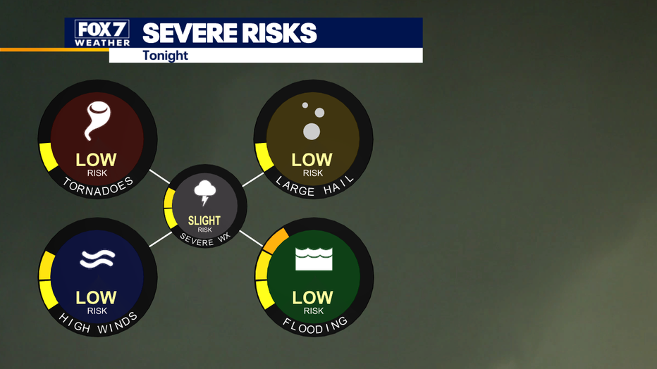
There is a marginal to slight risk of severe storms and localized flooding.

After the front pushes through, the weather will be wonderful for Election Day with sunny, cooler and drier conditions. Then here comes the next Pacific low to bring back the clouds and rain by the end of the week.
Buckle up, the weather pattern is turning very active all of a sudden.
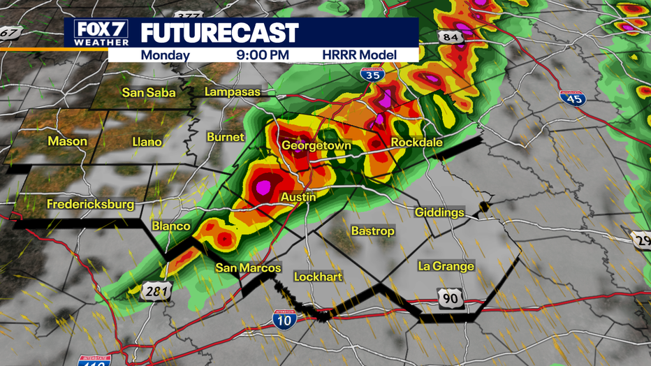
Most of the rain and storms will happen tonight. The Storm Prediction Center has upgraded us to a SLIGHT risk of severe storms. This means isolated severe storms are possible generating moderate sized hail and damaging winds.

Two rounds of storms are possible:
- First round: 3 - 5pm (isolated coverage)
- Second round: 6pm - 12am (numerous coverage)
Threats will be quarter sized hail, wind gusts of 50 - 60mph and there will be a low tornado risk.
The highest risk for hail will be along I-35 corridor and the highest risk of damaging winds from Austin to La Grange.

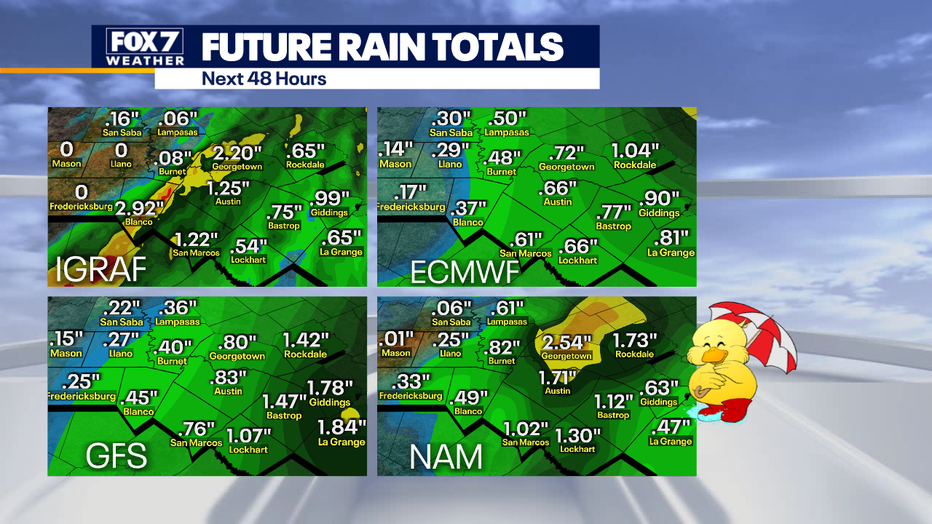
Rain totals are expected to be about .5 to 1" with isolated spots possibly getting 1-2".
Minor flooding with low-water crossings possible.
The Source: Information from FOX 7 Austin meteorologist Zack Shields.

